Contact project managers :
- Olivier RADAKOVITCH
- Marie SIMON-CORNU
- Sabine CHARMASSON
- Ludivine PASCUCCI-CAHEN

The AMORAD project aims to answer the key question of how to accurately assess the impact on humans and the environment of a release of radioactive substances. The goal is to optimize the models used to predict radionuclide dispersion in the environment and to assess their impact on two compartments of the biosphere: the marine environment and terrestrial ecosystems (including surface water). Special attention has also been given to the ocean-continent interface.
Completion dates : 2013-2022
Budget : €22 million, including €5.4 million from ANR
Partners : Andra, BRGM, CNRS, Ifremer, LSCE, French universities of Bordeaux, Pau, Toulon, Toulouse and Versailles, Japanese University of Tsukuba, CLS (Ifremer subsidiary), EDF
The accident at the Fukushima Dai-ichi nuclear power plant in March 2011 led to significant releases of radioactive substances that were dispersed in the atmosphere and the Pacific Ocean. Living species, both human and non-human, in nearby areas were exposed to these substances for varying periods, either externally or by ingestion of foods (plants grown in soil, seafood, etc.).
Assessment of the radiological and dosimetric consequences of the accident was based on two complementary approaches: taking radioactivity measurements in the environment and of people and using calculations and modeling to estimate parameters that could not be ascertained by means of measurement.
Although they already provide a large amount of data, the models available in 2011, developed following the Chernobyl accident, were flawed and required improvement. For example, it was necessary to improve spatial and temporal resolution to determine the concentrations of radioactive substances in each compartment of the exposed ecosystems: flora, fauna, water, sediments and soil. It was also necessary to improve the way these models handle fluxes of substances between these compartments, especially at certain specific interfaces (soil-plant, ocean-continent).
The AMORAD project aims to remove these obstacles using a combination of field data, laboratory experiments and the development of numerical models.
The AMORAD project is coordinated by IRSN and involves thirteen partners, including five French universities (Toulouse, Toulon, Bordeaux, Versailles Saint-Quentin, Pau and Pays de l’Adour), one Japanese university (Tsukuba) and five public and private undertakings (IFREMER, CEA, ANDRA, BRGM, EDF, CLS).
It links several disciplines (oceanography, chemistry, biology, radioecology, etc.). It was launched in 2013 to run for 6 years, but has been extended for 3 years and will now come to an end in 2022.
The project’s scale means that it covers all possible radionuclide exposure pathways for humans and the environment: external exposure and internal contamination by ingestion of foods.
The project looks at two main compartments of the biosphere — sea and land — making it possible to investigate radionuclide fluxes between them and at their interface. Studies have been conducted in several parts of France, Ukraine and Japan, with special ‘test areas’ set up on land contaminated by the Fukushima accident. The consortium has begun by generating a large amount of in-situ data in these areas.
The data have been used to calibrate and validate various modeling tools, designed to predict what happens to radionuclides following releases into the sea or the atmosphere, and how they are redistributed.
Spatial and temporal resolutions range from micrometers and hours (in the case of soil-to-plant transfers) to thousands of kilometers and several years (in the case of the marine food chain). Based on scenarios and various case studies, some of these models will be used to make recommendations for strategies to monitor environments and resources or actions to manage contaminated lands in the medium to long term.
Major progress has been made on the modeling of: 1) the transfer of contamination through soil erosion in a drainage basin, 2) the cesium and iodine cycles in forests, 3) the behavior of particles that carry radionuclides in aquatic environments (rivers, sea and ocean-continent interface) and 4) the transfers in the marine food chain.
In parallel, two other approaches have been developed in the marine environment to assess the potential impacts of a release: a system for characterizing resource vulnerability (combining impact indices and multiple criteria aggregation), and a system using general knowledge of sea currents in a particular area to provide rapid diagnostic and prognostic information, including for post-accident management.
Study of radionuclide transfer in sediments and food chains, and vulnerability of coastal areas to accident situations.
This research area aims to improve methods for assessing the impact on the marine environment (water, sediments and organisms) of an accidental release of radionuclides. The marine environment is often considered to be dispersive, i.e. to rapidly dilute contamination.

However, large concentration ‘pockets’ can occur in some compartments (radionuclides trapped in sediments, bioaccumulation in parts of biological chains), and major processes can occur at time scales and distances that are still not properly understood (powerful events like floods and storms causing the resuspension of contaminated sediments, intermittent supply by rivers leaching contaminated basins, etc.).
The majority of the research in this area concerns the processes by which radionuclides are carried within sediments and food chains, but some of the work is also looking at ways to improve environmental monitoring in an accident affecting the marine environment.
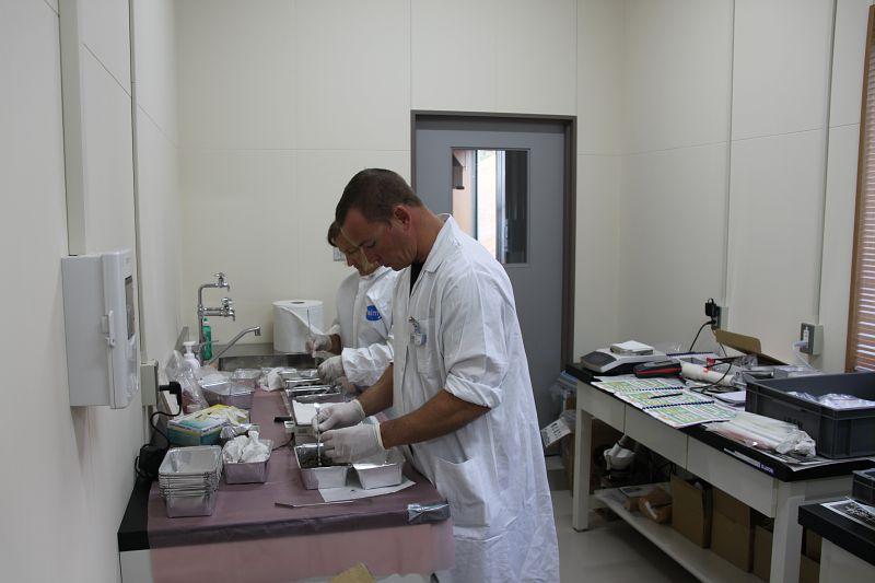
Four ‘test areas’ have been studied :
Transfers at the continent-ocean interface and the transport of particles over different time scales and distances have been studied in these areas, which function differently and so enable a number of different processes to be investigated.

The transfer of radionuclides in food chains and the sensitivity and vulnerability of the affected ecosystems have been studied for isolated organisms (oysters and tuna) and for entire food chains from the dissolved phase up to tuna and shark.
The study of ‘historical’ data sets for radionuclide concentrations in various marine organisms sampled in the Channel (seaweed, mollusks, crustaceans, fish) has determined their biological half-life (the time taken to eliminate half of their activity in these organisms). This is an important parameter to incorporate into ‘biokinetic’ models, which provide a quick method for assessing the change in radioactivity over time when managing an accident.
Maps of contamination risk indicators have been drawn up for different tuna populations off the Japanese coast based on hydrodynamic models giving the concentrations of radiocesium in the water and models for radiocesium transfer to the prey of tuna (zooplankton, crustaceans, small fish). These maps are subject to change over time.
A model taking into account the entire trophic network has been developed for the Fukushima area. It shows how the concentration of a specific radionuclide changes over time and space for a given species, based on fishing area. It takes 56 biological groups into account, from phytoplankton to tuna. This model is currently being validated and will be adapted to the Gulf of Lion.
Two decision support methods have been developed which should eventually lead to tools for use in operational emergency response situations. The first is based on the spatialization and assessment of different (economic and environmental) risk factors, and it aggregates these data to create an impact map for contamination following an accident. The second tool, which is equivalent to an expert system, can help with diagnosis and prognosis in post-accident situations. It uses current measurement databases to create standard scenarios for radionuclide redistribution in the dissolved phase.
Study of radionuclide transfers in continental environments
This area aims to provide a better understanding of and to quantify the processes of radionuclide transfer in forests and in the drainage basin-river continuum at different time scales.
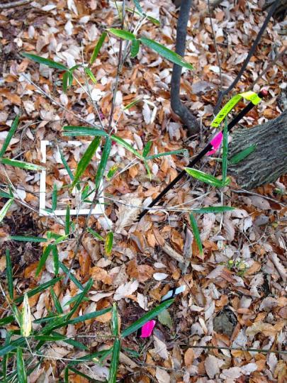
Erosion/run-off flows from drainage basins into rivers and then into the marine environment have been studied in the Fukushima area. As a result, the impact of erosion processes and floods on particle distribution have been analyzed. The areas of study were the drainage basins to the north-west of the Fukushima nuclear power plant, which drain the main area affected by fallout from the radioactive plume.
A method has been developed to quantify radionuclide export from the drainage basins to the sea. In particular, a model was created to reproduce soil erosion and predict the transfer of the contaminated sediments in the drainage basins, while taking account of the different types of land use and hydroclimatic forcing.
The biogeochemical cycle of radionuclides in forest systems has been characterized, making it possible to model the evolution of cesium in the different compartments. A large amount of data has been collected within an 80 km radius of the Fukushima plant, and also near Chernobyl and from various French forest sites. At Fukushima, cesium-137 activity rapidly decreases in trees but increases in organic layers and minerals in the soil (transfer by falling leaves, liquid fluxes). It should probably reach equilibrium in the next few years. The TREE4 model for predicting the evolution of cesium-137 stocks and concentrations in the different compartments of the soil-tree system is now operational.
The AMORAD project was originally scheduled to end in 2019, but its research program has been extended until 2022.
AMORAD II will provide further knowledge of radionuclide transfer processes in continental environments (soil-forest) and in drainage basins, through soil erosion. For this purpose, the BRGM’s Watersed simulation model will be enhanced by the addition of a module for radiocesium and will be tested on data from a Fukushima drainage basin.
An economic section has been added to the program to complete the development of the ARPAGON computer code (IRSN), which is used to assess the direct costs of land contamination after a severe accident at a nuclear power plant. The aim is to take into account in its calculations the economic impacts associated with loss of forest and water resources and with obligations to stop drinking water supply and irrigation. To do this, economic data first has to be collected and validated at appropriate spatial scales for calculation. Some data are only available on a local scale, and others only on a national scale.
Laboratories : LEREN - LRC - LRTA - LR2T - LETIS - LIMAR
LEREN is responsible for studying the behavior of radionuclides, particularly in the continental zone of mainland France and in the Mediterranean maritime zone.
The LRC reports to the Director of Environment within the Health and Environment Division (PSE). Its main research theme is the study of radionuclide transport and transfer processes in the environment.
The LRTA is attached to the Director of Environment within the "Health and Environment" Pole (PSE). The laboratory's general missions are to describe, analyze and model radionuclide transfers and flows in space and time, on a continuum linking watersheds and the marine environment.
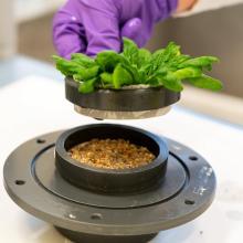
LR2T reports to the Director of Environment within the Health and Environment Division (PSE). It conducts studies and research to characterize the exposure of living organisms to pollutants from nuclear activities in continental, aquatic and terrestrial ecosystems, whether in chronic or post-accident situations.
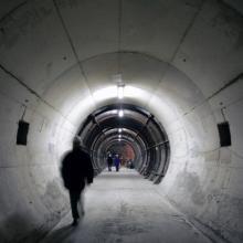
The mission of LETIS is to define and implement research programs in the field of waste disposal safety in geological formations.
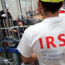
The general mission of the LEMC laboratory is to develop and maintain up-to-date knowledge of the behavior of fuel rods used in nuclear power.
Contact project managers :